Wikipedia does not have a File page with this exact name.
Other reasons this message may be displayed:
|
File:2007-Map-Avianflu-zones.png
From WikiMD.com Medical Encyclopedia
No higher resolution available.
2007-Map-Avianflu-zones.png (438 × 560 pixels, file size: 39 KB, MIME type: image/png)
File history
Click on a date/time to view the file as it appeared at that time.
| Date/Time | Thumbnail | Dimensions | User | Comment | |
|---|---|---|---|---|---|
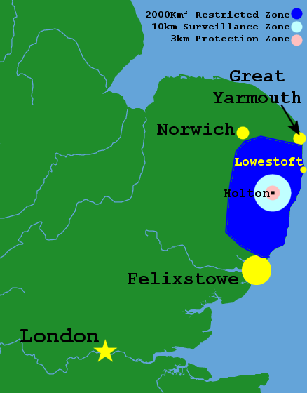
| current | 20:03, 4 February 2007 | | 438 × 560 (39 KB) | J.P.Lon~commonswiki | Map of the zones during Feb 2007 Avian Flu outbreak in Holton, Suffolk on the Bernard Matthews farm. |
File usage
The following file is a duplicate of this file (more details):
- File:2007-Map-Avianflu-zones.png from Wikimedia Commons
The following page uses this file: