Wikipedia does not have a File page with this exact name.
Other reasons this message may be displayed:
|
File:Altai, Tienschan-Orte.png
From WikiMD.com - Food, Medicine & Wellness Encyclopedia
No higher resolution available.
Altai,_Tienschan-Orte.png (660 × 471 pixels, file size: 560 KB, MIME type: image/png)
File history
Click on a date/time to view the file as it appeared at that time.
| Date/Time | Thumbnail | Dimensions | User | Comment | |
|---|---|---|---|---|---|
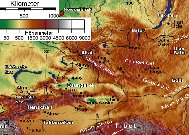
| current | 15:36, 26 March 2006 | | 660 × 471 (560 KB) | Hardscarf | * Description: Relief Sattelite image Altay mountains and Tian Shan * Beschreibung: Relief-Satellitenbild Altai-Gebirgsketten und Tienschan * Quelle: [Bild:Mongolei-SinkiangTxt.png] * nachbearbeitet 30.5.2005 von Benutzer:Geof (passender Ausschnitt, Maß |
File usage
The following file is a duplicate of this file (more details):
- File:Altai, Tienschan-Orte.png from Wikimedia Commons
The following page uses this file: