Wikipedia does not have a File page with this exact name.
Other reasons this message may be displayed:
|
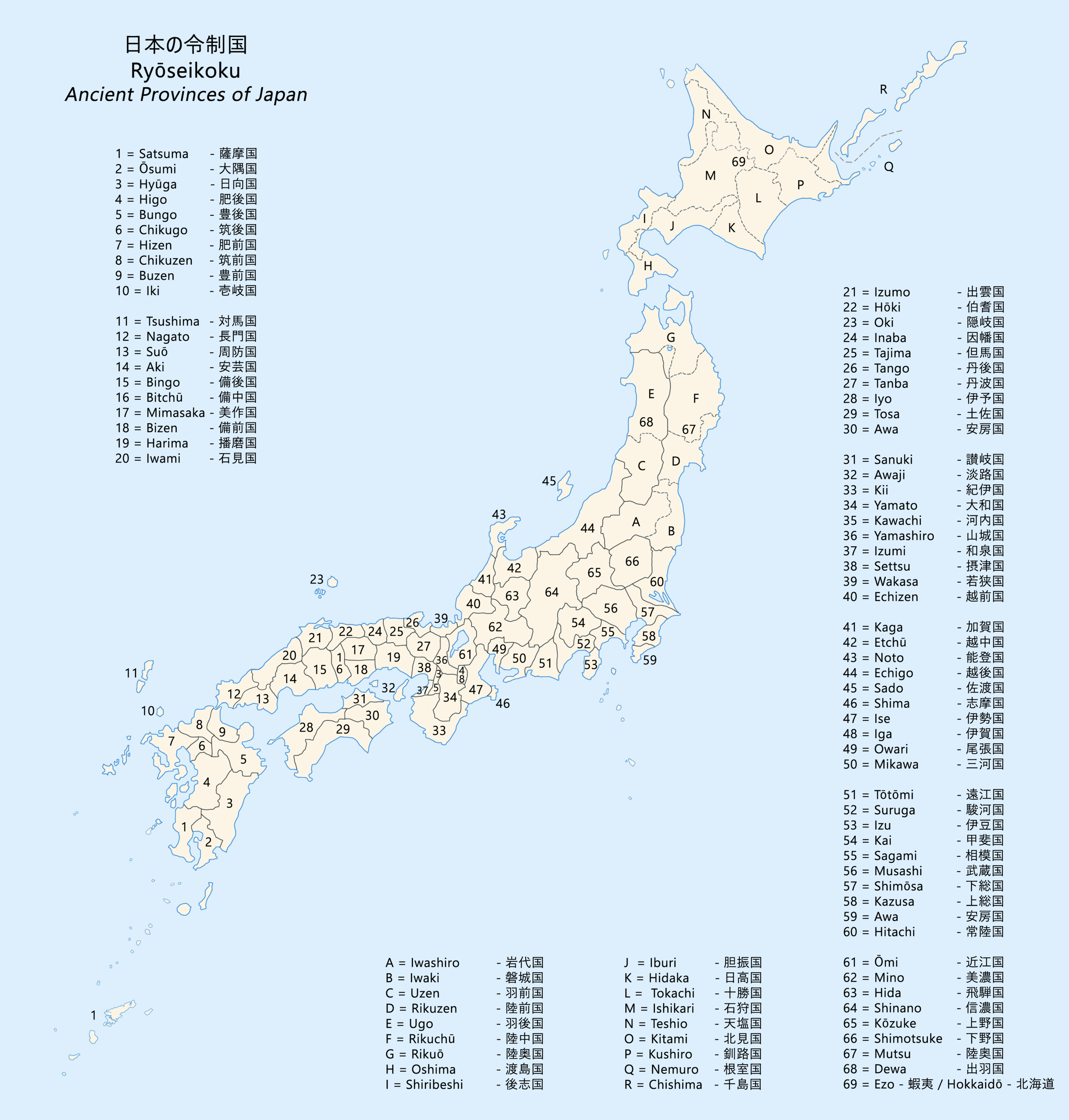
File:Ancient Provinces of Japan Ryoseikoku Map.png
From WikiMD's Food, Medicine & Wellness Encyclopedia
Size of this preview: 572 × 599 pixels. Other resolutions: 1,954 × 2,048 pixels | 3,031 × 3,176 pixels.
Original file (3,031 × 3,176 pixels, file size: 2.22 MB, MIME type: image/png)
File history
Click on a date/time to view the file as it appeared at that time.
| Date/Time | Thumbnail | Dimensions | User | Comment | |
|---|---|---|---|---|---|
| current | 18:19, 5 December 2022 | | 3,031 × 3,176 (2.22 MB) | まいまいようお | 長門国・周防国・豊前国の国境線と関門海峡の地形を修正 |
File usage
The following file is a duplicate of this file (more details):
- File:Ancient Provinces of Japan Ryoseikoku Map.png from Wikimedia Commons
The following page uses this file: