Wikipedia does not have a File page with this exact name.
Other reasons this message may be displayed:
|
File:Barentsz arctic map.jpg
From WikiMD's Food, Medicine & Wellness Encyclopedia
No higher resolution available.
Barentsz_arctic_map.jpg (650 × 517 pixels, file size: 102 KB, MIME type: image/jpeg)
File history
Click on a date/time to view the file as it appeared at that time.
| Date/Time | Thumbnail | Dimensions | User | Comment | |
|---|---|---|---|---|---|
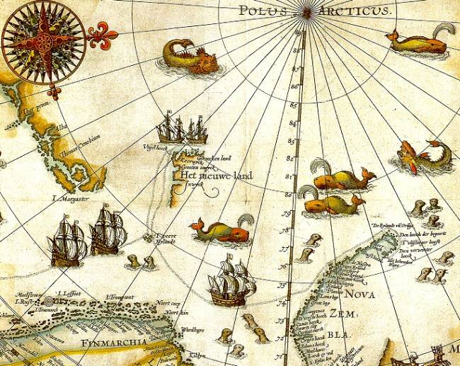
| current | 09:14, 26 July 2006 | | 650 × 517 (102 KB) | TheGrappler | {{Information |Description=Portion of 1599 map of Arctic exploration by Willem Barentsz. Spitsbergen, here mapped for the first time, is indicated as "Het Nieuwe Land" (Dutch for "the New Land"), center-left. |Source=[http://www.ub.uit.no/northernlights/e |
File usage
The following file is a duplicate of this file (more details):
- File:Barentsz arctic map.jpg from Wikimedia Commons
The following page uses this file: