Wikipedia does not have a File page with this exact name.
Other reasons this message may be displayed:
|
File:Extent of territorial control in sri lanka.png
From WikiMD's Food, Medicine & Wellness Encyclopedia
Size of this preview: 375 × 599 pixels. Other resolution: 601 × 960 pixels.
Original file (601 × 960 pixels, file size: 243 KB, MIME type: image/png)
File history
Click on a date/time to view the file as it appeared at that time.
| Date/Time | Thumbnail | Dimensions | User | Comment | |
|---|---|---|---|---|---|
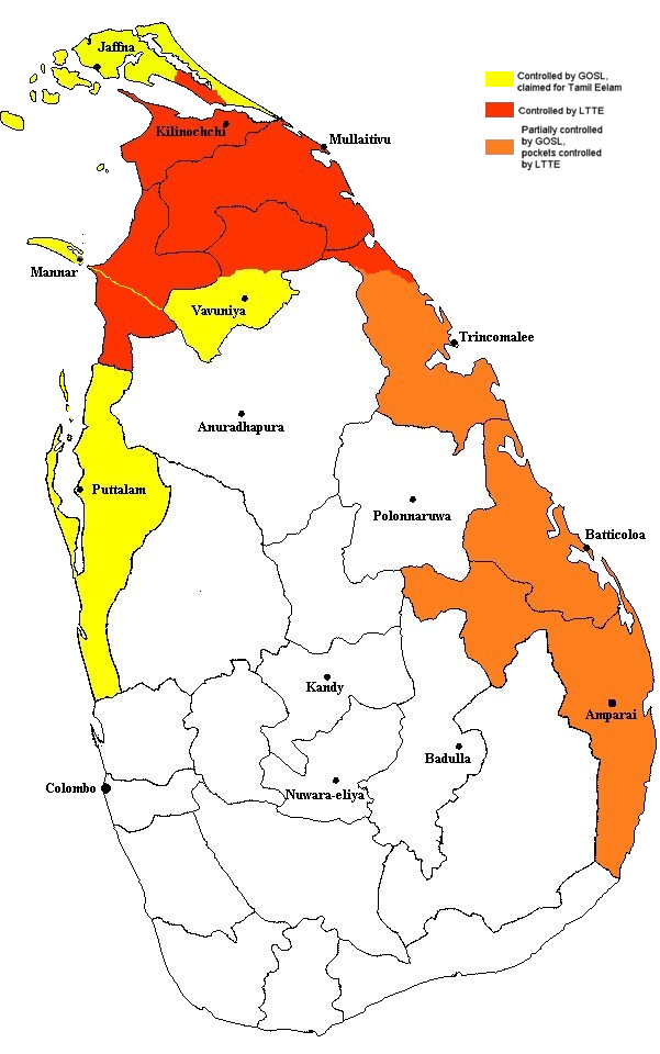
| current | 22:19, 28 December 2005 | | 601 × 960 (243 KB) | Vadakkan | This map approximately shows the areas of Sri Lanka controlled by the LTTE and the Government, as of December 2005. The information as to areas of control was taken from a report issued by the European Union. The map was originally uploaded to :en by [[:e |
File usage
The following file is a duplicate of this file (more details):
- File:Extent of territorial control in sri lanka.png from Wikimedia Commons
The following page uses this file: