Wikipedia does not have a File page with this exact name.
Other reasons this message may be displayed:
|
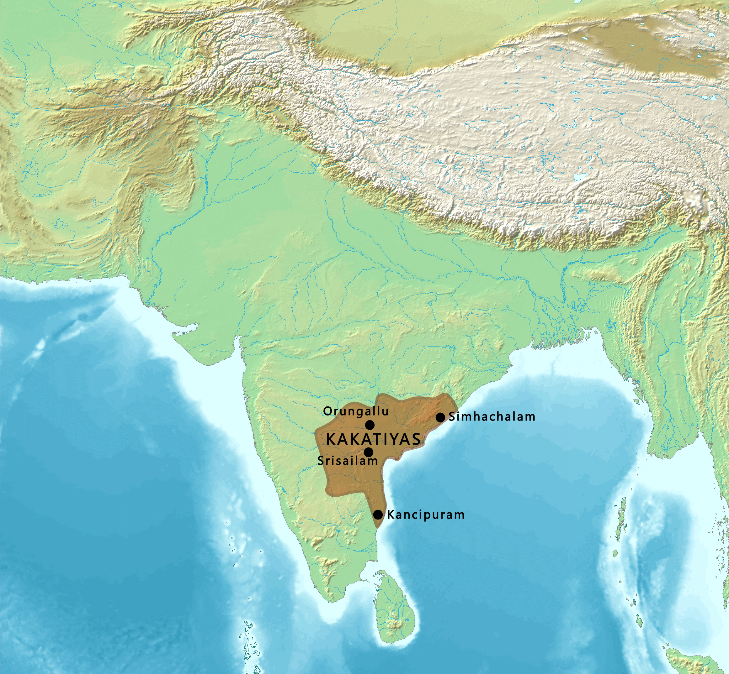
File:Map of the Kakatiyas.png
From WikiMD's Food, Medicine & Wellness Encyclopedia
Size of this preview: 648 × 600 pixels. Other resolution: 2,324 × 2,151 pixels.
Original file (2,324 × 2,151 pixels, file size: 6.94 MB, MIME type: image/png)
File history
Click on a date/time to view the file as it appeared at that time.
| Date/Time | Thumbnail | Dimensions | User | Comment | |
|---|---|---|---|---|---|
| current | 05:26, 12 February 2022 | | 2,324 × 2,151 (6.94 MB) | पाटलिपुत्र | Uploaded a work by Map created from [http://www2.demis.nl/mapserver/mapper.asp DEMIS Mapserver], which are public domain. Koba-chan.<br> Reference: [https://dsal.uchicago.edu/reference/schwartzberg/pager.html?object=183] from {{extracted from|File:South Asia non political, with rivers.jpg}} with UploadWizard |
File usage
The following file is a duplicate of this file (more details):
- File:Map of the Kakatiyas.png from Wikimedia Commons
The following page uses this file: