Wikipedia does not have a File page with this exact name.
Other reasons this message may be displayed:
|
File:Palliser's Triangle map.png
From WikiMD's Food, Medicine & Wellness Encyclopedia
Size of this preview: 780 × 600 pixels. Other resolution: 1,000 × 769 pixels.
Original file (1,000 × 769 pixels, file size: 301 KB, MIME type: image/png)
File history
Click on a date/time to view the file as it appeared at that time.
| Date/Time | Thumbnail | Dimensions | User | Comment | |
|---|---|---|---|---|---|
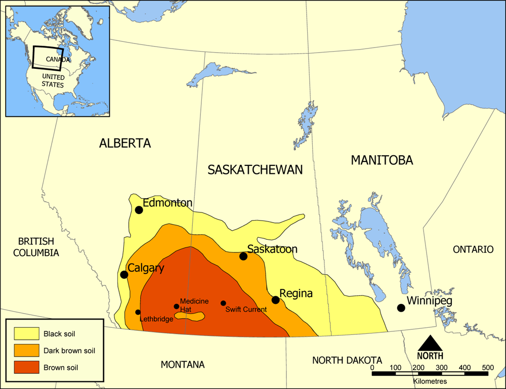
| current | 15:50, 18 July 2005 | | 1,000 × 769 (301 KB) | NormanEinstein | Map showing the extent of Palliser's Triangle in Western Canada. The area covers parts of Alberta, Saskatchewan, and Manitoba and is notable for its lack of trees. The lack of sturdy vegetation devastated the area during the Dust Bowl of the 1930s, but mo |
File usage
The following file is a duplicate of this file (more details):
- File:Palliser's Triangle map.png from Wikimedia Commons
The following page uses this file: