Wikipedia does not have a File page with this exact name.
Other reasons this message may be displayed:
|
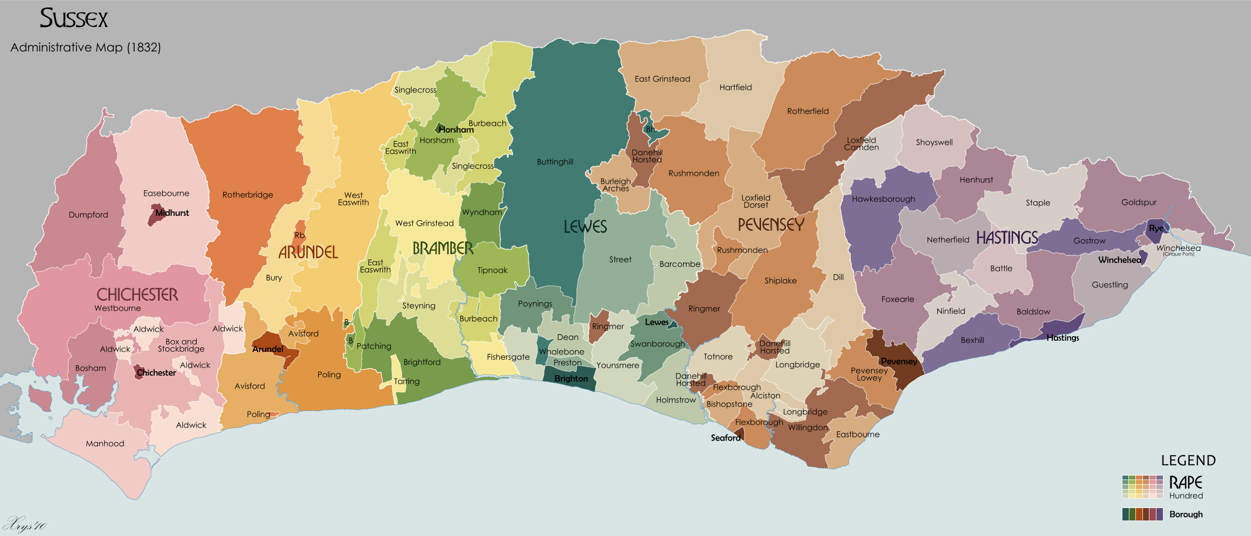
File:Sussex administrative map 1832.png
From WikiMD.com Medical Encyclopedia
Size of this preview: 800 × 343 pixels. Other resolution: 2,500 × 1,073 pixels.
Original file (2,500 × 1,073 pixels, file size: 644 KB, MIME type: image/png)
File history
Click on a date/time to view the file as it appeared at that time.
| Date/Time | Thumbnail | Dimensions | User | Comment | |
|---|---|---|---|---|---|
| current | 19:57, 17 October 2010 | | 2,500 × 1,073 (644 KB) | XrysD | {{Information |Description={{en|1=Administrative map of the ancient county of Sussex in 1832. Showing Rapes, Hundreds, Boroughs. Source data on parish boundaries - Kain, R.J.P., and Oliver, R.R. (2001) "Historic parishes of England and Wales: Electronic M |
File usage
The following file is a duplicate of this file (more details):
- File:Sussex administrative map 1832.png from Wikimedia Commons
The following page uses this file: