Wikipedia does not have a File page with this exact name.
Other reasons this message may be displayed:
|
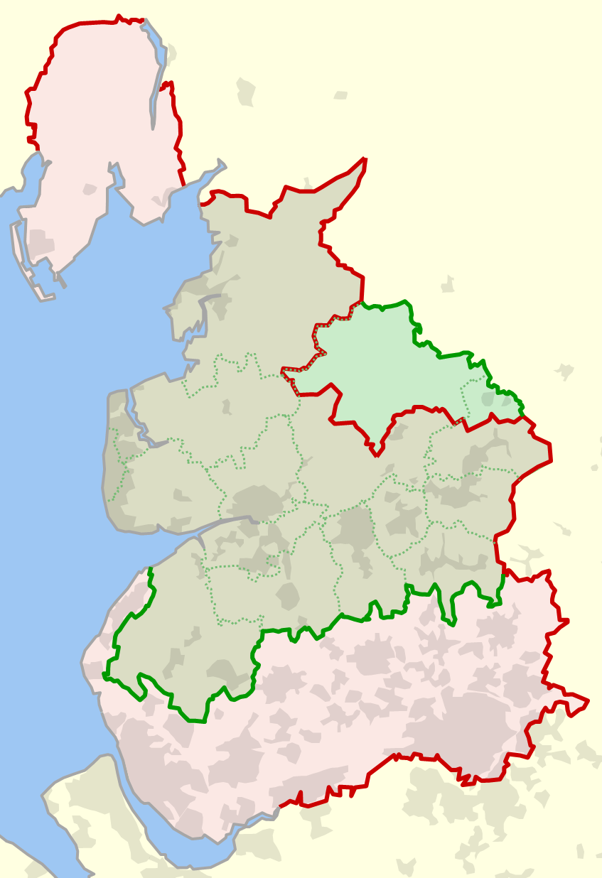
File:Historical and current boundaries of Lancashire.png
From WikiMD's Food, Medicine & Wellness Encyclopedia
Size of this preview: 411 × 600 pixels. Other resolution: 847 × 1,236 pixels.
Original file (847 × 1,236 pixels, file size: 191 KB, MIME type: image/png)
File history
Click on a date/time to view the file as it appeared at that time.
| Date/Time | Thumbnail | Dimensions | User | Comment | |
|---|---|---|---|---|---|
| current | 22:14, 12 June 2010 | | 847 × 1,236 (191 KB) | Dr Greg | {{Information |Description={{en|1=The historical boundary of the county of en:Lancashire, England, shown in red, and the modern-day boundary (since 1974), shown in green. Also shown in dotted green are the modern-day local government districts and u |
File usage
The following file is a duplicate of this file (more details):
- File:Historical and current boundaries of Lancashire.png from Wikimedia Commons
The following page uses this file: