Topography

Topography refers to the arrangement of the natural and artificial physical features of an area. It is a field of geoscience and planetary science concerned with the detailed mapping and description of the surface features of land. Topography involves the recording of relief or terrain, the three-dimensional quality of the surface, and the identification of specific landforms.
Etymology[edit]
The term "topography" originates from the Greek words "topos" meaning "place" and "graphia" meaning "writing" or "description". It was first used in the context of detailed descriptions of places in ancient Greece.
History[edit]
Historically, topography was a field of cartography and surveying. Early topographic maps were created by explorers and surveyors who would measure the land using tools like the theodolite and sextant.
Modern Topography[edit]

In modern times, topography is often conducted using remote sensing technologies such as satellite imagery and aerial photography. LIDAR and radar are also used to create detailed topographic maps. These technologies allow for the creation of digital elevation models (DEMs) that provide a three-dimensional representation of the terrain.
Applications[edit]
Topography is crucial in various fields such as geology, geography, civil engineering, and architecture. It is used in urban planning, landscape architecture, and environmental science to assess the suitability of land for various uses.
Topographic Maps[edit]

Topographic maps are characterized by large-scale detail and quantitative representation of relief, usually using contour lines. These maps are used for hiking, mining, civil engineering, and military purposes.
Surveying Techniques[edit]

Traditional surveying techniques involve the use of transits, levels, and total stations. Modern techniques include GPS and GIS technologies, which allow for more accurate and efficient data collection.
Related Pages[edit]
Topography[edit]
-
 Sierra Nevada topography
 -
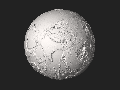
 3D topographic model
 -
 Earth dry elevation model


Medical Disclaimer: WikiMD is for informational purposes only and is not a substitute for professional medical advice. Content may be inaccurate or outdated and should not be used for diagnosis or treatment. Always consult your healthcare provider for medical decisions. Verify information with trusted sources such as CDC.gov and NIH.gov. By using this site, you agree that WikiMD is not liable for any outcomes related to its content. See full disclaimer.
Credits:Most images are courtesy of Wikimedia commons, and templates, categories Wikipedia, licensed under CC BY SA or similar.
Translate page: - East Asian
中文,
日本,
한국어,
South Asian
हिन्दी,
தமிழ்,
తెలుగు,
Urdu,
ಕನ್ನಡ,
Southeast Asian
Indonesian,
Vietnamese,
Thai,
မြန်မာဘာသာ,
বাংলা
European
español,
Deutsch,
français,
Greek,
português do Brasil,
polski,
română,
русский,
Nederlands,
norsk,
svenska,
suomi,
Italian
Middle Eastern & African
عربى,
Turkish,
Persian,
Hebrew,
Afrikaans,
isiZulu,
Kiswahili,
Other
Bulgarian,
Hungarian,
Czech,
Swedish,
മലയാളം,
मराठी,
ਪੰਜਾਬੀ,
ગુજરાતી,
Portuguese,
Ukrainian
