Global Positioning System
Global Positioning System (GPS), originally Navstar GPS, is a satellite-based radionavigation system owned by the United States government and operated by the United States Space Force. It provides geolocation and time information to a GPS receiver anywhere on or near the Earth where there is an unobstructed line of sight to four or more GPS satellites. The system offers critical capabilities to military, civil, and commercial users around the world. It is freely accessible to anyone with a GPS receiver.
History[edit]
The development of GPS was initiated in the 1960s as a military navigation tool by the United States Department of Defense, with the first satellite launched in 1978. The system became fully operational in 1995. Originally intended for military applications, the policy was changed in the 1980s to allow civilian access to the system, which has since become a ubiquitous utility supporting numerous industries and technologies worldwide.
System Components[edit]
The GPS consists of three main segments: the space segment, the control segment, and the user segment.
Space Segment[edit]
The space segment comprises a constellation of at least 24 satellites in medium Earth orbit. These satellites transmit signals that allow GPS receivers to determine the receiver's location, speed, and direction.
Control Segment[edit]
The control segment consists of a global network of ground facilities that track the satellites, monitor their transmissions, perform analyses, and send commands and data to the constellation.
User Segment[edit]
The user segment includes the GPS receivers themselves, which can be found in many devices such as smartphones, car navigation systems, and specialized GPS devices used for mapping, surveying, and other applications.
How GPS Works[edit]
GPS satellites circle the Earth in a very precise orbit and transmit signal information to Earth. GPS receivers take this information and use triangulation to calculate the user's exact location. Essentially, the GPS receiver compares the time a signal was transmitted by a satellite with the time it was received. The time difference tells the GPS receiver how far away the satellite is. With distance measurements from a few more satellites, the receiver can determine the user's position and display it electronically.
Applications[edit]
GPS has a wide range of applications, including navigation, surveying, mapping, and timing. It is essential for the functioning of the global financial system, telecommunications, and other critical infrastructure. GPS technology is also used in personal devices such as smartphones and wearable fitness devices.
Challenges and Limitations[edit]
Despite its widespread use, GPS is not without its challenges. Signal blockage by buildings, interference from other electronic devices, and atmospheric conditions can affect accuracy. Additionally, the system is vulnerable to intentional jamming and spoofing.
Future Developments[edit]
Efforts are ongoing to enhance the robustness and accuracy of GPS. This includes the deployment of new satellites with advanced capabilities, improvements to the ground control system, and the development of new applications and technologies that leverage GPS data.
See Also[edit]
-
 NAVSTAR GPS logo
 -
 GPS Block IIIA
 -
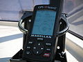 Magellan GPS Blazer12
 -
 Kyoto Taxi Ride
 -
 2nd Space Operations Squadron
 -
 AFSC Film, NAVSTAR GPS Circa 1977
 -
 GPS 24 golden
 -
 Managers for the Timation program
 -
 Navigation Technology Satellite – II
 -
 GPS-0012 San Diego Air & Space Museum
 -
 2nd Space Operations Squadron emblem
 -
 Dr Gladys West


.jpeg)


Medical Disclaimer: WikiMD is for informational purposes only and is not a substitute for professional medical advice. Content may be inaccurate or outdated and should not be used for diagnosis or treatment. Always consult your healthcare provider for medical decisions. Verify information with trusted sources such as CDC.gov and NIH.gov. By using this site, you agree that WikiMD is not liable for any outcomes related to its content. See full disclaimer.
Credits:Most images are courtesy of Wikimedia commons, and templates, categories Wikipedia, licensed under CC BY SA or similar.
Translate page: - East Asian
中文,
日本,
한국어,
South Asian
हिन्दी,
தமிழ்,
తెలుగు,
Urdu,
ಕನ್ನಡ,
Southeast Asian
Indonesian,
Vietnamese,
Thai,
မြန်မာဘာသာ,
বাংলা
European
español,
Deutsch,
français,
Greek,
português do Brasil,
polski,
română,
русский,
Nederlands,
norsk,
svenska,
suomi,
Italian
Middle Eastern & African
عربى,
Turkish,
Persian,
Hebrew,
Afrikaans,
isiZulu,
Kiswahili,
Other
Bulgarian,
Hungarian,
Czech,
Swedish,
മലയാളം,
मराठी,
ਪੰਜਾਬੀ,
ગુજરાતી,
Portuguese,
Ukrainian
